August 05, 2007
Quick Way of Adding Weather to the Foot and Mouth Map
[For a Google Map showing the current (as of August 3, 2007) "foot and mouth exclusion zone", try here: Foot and Mouth Map, as of 3/8/07.]
A comment on Ed Parson's Foot and Mouth - a Geographical Problem post suggests:
The usefulness of the tool or otherwise comes from what analysis can be done with the output. Given that F&M can often be distributed as an airborne disease, some means of showing the wind direction and speed over time makes this more than just a pretty coloured map...
I agree that it would be useful to be able to overlay wind speed and direction markers on to an emergency response map. And I wonder how difficult it would be to use such data to transform (even approximately) a circular overlay to one that reflects the likely distribution of a gas release, say, given prevailing wind conditions?
The more I think about it, the more I can see a use for an "emergency response web 2.0" toolkit that would allow the rapid construction of an information website to aggregate information in the case of an emergency. A combination of something like Ning and IBM's QEDWiki (which I really need to get round to playing with...!), maybe?
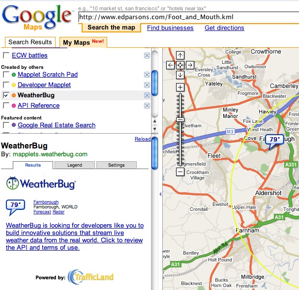
Anyway, as a stop gap on the weather thing, a quick search on Google MyMaps ("Add content") turns up this mapplet that can display the wind conditions from various locations around the world, including one not far from Guildford:
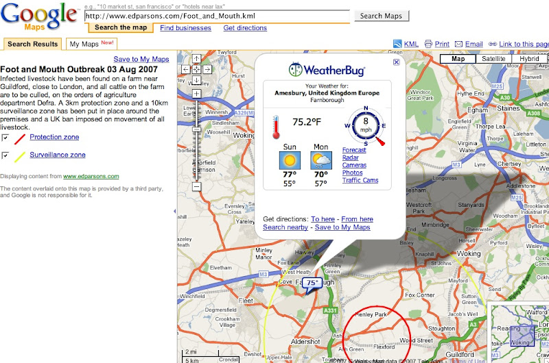
Clicking on the temperature marker opens up a pop-up that includes wind direction data:
The Mapplet is provided by WeatherBug and can be found here: WeatherBug Mapplet.
One thing that jumps out at me looking at that map - it would be sensible to make a semi-transparent coloured filter layer within the two circle overlays on the map.
I've not really looked at KML yet, so maybe now's a good time for me to find out a little more about it, and try to add a semi-transparent layer in? ;-)
Posted by ajh59 at August 5, 2007 11:54 AM