August 04, 2007
More UK Emergency Mapping Opportunites - Foot and Mouth
[For a Google Map showing the current (as of August 3, 2007) "foot and mouth exclusion zone", try here: Foot and Mouth Map, as of 3/8/07.]
A couple of weeks ago it was floods, and I put together a Google map mashup of clean water bowser locations in Gloucester, and now it's a foot and mouth alert (UPDATE: 10 Facts About Foot and Mouth Disease.)
I caught the news as I was driving home tonight, (I wasn't too far from the location of the outbreak at the time!) and when I heard a three kilometer exclusion protection zone and five kilometer surveillance zone had been imposed, my first thought was to wonder how easy it would be to plot some circular map overlays onto a Google map, a visualisation effect I originally saw demonstrated by Eric Meyer's HYDESim: High Yield Detonation Effects Simulator.

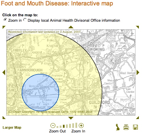
Checking on the defra Foot and Mouth Disease website, I found they'd already got an interactive map - of sorts - up already, although it's by no means as slick as a Google maps interface.
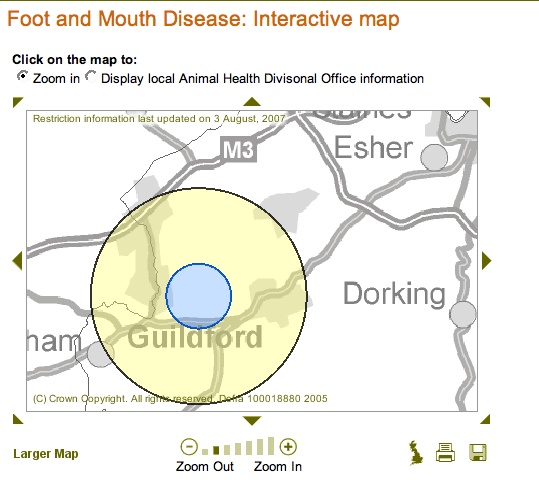
For example, the map isn't draggable and the pan and zoom effects are quite coarse grained:
The BBC News site has gone for a static map:

(Interestingly, there was no information that I could find on the UK Resilience homepage, even though COBRA had been called. I'd have thought the two would be related, for some reason.)
It's a bit late now to start trying to put together a Google map equivalent of the above (in case it takes longer than I expect!) but as potential building blocks I found this site that uses calls on the Google maps API to plot a circle - Google Maps clickable circle generator - as well as a more general application for creating Google Map overlays - Google Maps-API Application for Digitizing (GMAD).
And here's a script that will calculate the distance between two latitude/longitude points.
If you come across a foot and mouth exclusion zone Google map, please send me the link :-)
UPDATE: Ed Parsons has just posted a KML file for the surveillance and protection zones:
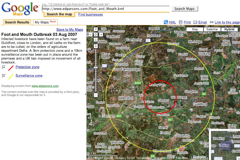
See it overlayed on a Google map.
[UPDATE 17/7/07: There have a been a few earthquakes recently, and the mashups that have sprung up around them look like they may contain some reusable circle overlay plotting tricks..?]
PS How come I missed this - the Google maps polygon API; check out this example app: GPolygon Example
Posted by ajh59 at August 4, 2007 01:23 AMThanks Tony: http://microbiologybytes.wordpress.com/2007/08/04/uk-foot-and-mouth-disease-outbreak/
Posted by: AJ Cann at August 4, 2007 07:40 AM