I've been wondering about what would make for a good educational demo of Google Earth'n'data mashups, and "rediscovering" the water borne transmission of cholera looks promising...
I found a copy of Snow's 1854 cholera data (possibly?!) so now I need:
- a way of turning the map position data into geo-data;
- an 1854 Google Earth map overlay for the appropriate part of London (something like this maybe?).
If you know if anyone has done this already, please drop me a line... :-)
Posted by ajh59 at July 23, 2007 12:39 AM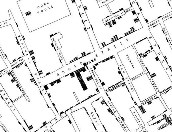